As your self-appointed education officer and fellow perpetual student, it is my duty to inform you of an upcoming MOOC on the Futurelearn platform, entitled “Monitoring the Oceans from Space“. In the five weeks of the course, which starts on 24 October, you will learn about using satellite data to monitor the health of the oceans. You will also learn how to access some of the ocean monitoring data that is collected every day about weather phenomena, icebergs, sea levels, ocean temperature, and more. If you’re into creating your own visualisations or crunching numbers yourself, this should appeal.
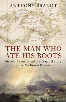
The Man Who Ate His Boots: The Tragic History of the Search for the Northwest Passage – Anthony Brandt
The Man Who Ate His Boots
The Northwest Passage is a sea route (routes, actually) running between Canada and Greenland, across the top of the North American continent through the Canadian Arctic Archipelago, and through the Bering Sea between Alaska and Russia. At its end is the Far East, for hundreds of years the destination of the thousands of sea voyages that made their way around the Cape of Good Hope, and later through the Suez Canal. Its existence was an enormously appealing idea to Europeans, because if the east could be reached by sailing along the top of the world, great savings of sailing time and expense would result.
For a long time the existence of the Northwest Passage was merely a hypothesis, and in the 1800s the British expended vast quantities of energy exploring the Canadian Arctic in search of a sea route. The passage was first traversed in 1850-54 by Robert McClure, by ship and sledge. Roald Amundsen traversed it entirely by ship in 1903-1906. Until this century, the route was not navigable for most of the year owing to the presence of sea ice. Now, thanks (?) to climate change, there is far less ice to contend with.
Sir John Franklin was one of Britain’s most eminent Arctic explorers. He made several trips to the Arctic in search of the Northwest Passage. His final expedition, starting in 1845, ended in the disappearance of his two ships (HMS Erebus and HMS Terror), Franklin himself, and all 128 of the men with him.
The story of his expedition, and the searches for evidence of its fate (upwards of 30 expeditions were mounted to look for him), and the subsequent discovery of what had happened (no spoilers here – it was awful) is related in gripping detail in The Man Who Ate His Boots. Brandt also provides ample historical context, describing prior expeditions which serve to illuminate the British motivations behind their exploration of the Canadian Arctic.
There was a curious mixture of stoic heroism and wild arrogance at work during this period of British history. The rigors endured by early Arctic explorers cannot be overstated – the environment is almost entirely hostile to human survival. The British did not believe that there was anything to be learned from the Inuit, indigenous people who live widely spread across the area, and suffered as a result. As one of the Inuit pointed out when the awful lengths Franklin’s men had gone to in order to try to survive were revealed, his people “know how to starve.”
There is a strong thread throughout this book relating to the colonial attitude towards colonised peoples. A belief prevailed in Britain that, equipped with a shotgun and a good pair of shoes, an Englishman could survive anywhere, and that his Christian piety would serve to protect him and speed his endeavours. (On one of Franklin’s earlier expeditions, which was a complete fiasco largely owing to poor planning, the British officers survived whereas the mixed-race local fur traders – who were doing all the manual work and carrying the supplies – perished. This was attributed to the protective influence of the Christian beliefs of the British men.) It was further reckoned that there was nothing to be gained from studying the techinques of the Inuit. Eyewitness accounts from Inuit turned out to hold the key to the fate of Franklin’s party, although their account was not believed initially (they were dismissed as habitually lying “savages”).
You can read reviews of The Man Who Ate His Boots at the New York Times, Washington Post, and The Guardian. If you enjoyed Endurance, then I recommend you investigate this book. In light of the developing findings of the excavation of HMS Erebus, the material has refreshed relevance today.
Lovers of shipwrecks and wilderness will enjoy the Shipwreck Trail (also called the Thomas T Tucker Trail, which has a nice alliterative ring to it) in the Cape Point Nature Reserve. Tami, Maria and I did it on one cloudy Saturday, close to low tide. (You can do the walk at high tide, but you won’t be able to get as close to the wrecks and some parts of the wreckage will be underwater.) The trail starts from the Olifantsbos parking area inside the reserve. There is a large sign saying THOMAS T TUCKER, which will send you on your way. A waist-high pyramid-shaped cairn of stones indicates where you must climb over the dunes onto the beach – the actual path is hard to discern at this point owing to fire damage.
Rockpools abound near Olifantsbos
The path follows the coast past the Olifantsbos Cottage to the next beach, where the remains of the Thomas T Tucker are strewn around. Don’t rush past the beach outside Olifantsbos Cottage, though – there is a huge wooden log, bored by teredo worms, with rust marks at its base showing where it was attached to the deck of a ship or where fittings for lifting by crane were located.
It is possible that this is one of several hundred okoume logs that came off a cargo vessel called Lolain Table Bay in 2008. The ship was apparently in very bad repair. Similar logs can be found at Hoek van Bobbejaan, Sandy Bay, and other locations along the Atlantic coast. (Incidentally, those logs were predicted to cause havoc in the 2008 storm that uncovered the wreck of the Commodore II.)
The mast on Olifantsbos beach
On the beach near the Thomas T Tucker you will also see some whale bones, which are becoming more and more damaged with each passing selfie, but are still impressive in scale. I suspect that more of that skeleton is on display at the Buffelsfontein Visitors Centre near Buffels Bay in the park.
Whale skull near the Thomas T Tucker
Continuing past the main wreckage of the Thomas T Tucker you will come across another small piece of rusty metal, which belongs to the same wreck even though it is so far away from the rest of the debris. Shortly you will spy the wreck of the Nolloth on the beach before you. Don’t overlook the rockpools on the way.
Moody skies over Misty Cliffs
A cairn marks the entrance onto the beach
Tami and Maria on the way
Rocky shores near the head of the trail
Ours were the first footprints on the beach
Scarborough and Misty Cliffs in the distance
Looking back from near the Olifantsbos cottage
Blasted tree at the southern end of Olifantsbos beach
What makes these tracks on the beach?
A mysterious abandoned buoy in the surf at the Thomas T Tucker
The Nolloth is in the distance
Fishing net on the beach between the two wrecks
Lush green south of the Nolloth
Fire damage near Sirkelsvlei
Teredo worms have bored into the mast
The route back can either be a retracement of your steps along the coast, or via the inland path marked by a sign on the edge of the beach just past the Nolloth. We struggled a bit to find the path as the plant life in the area has not recovered since the March fires, and in retrospect we’d probably have gotten on much better (and returned home much cleaner) if we’d just walked back along the beach!
Baboon footprints on Olifantsbos beach
You shouldn’t do any walking in the reserve without a proper map; my favourite is the Slingsby Map series. I got mine from the curio shop at Kirstenbosch, and they are available at most major bookstores (with a bias towards those in the south peninsula – I have seen them at both Wordsworth and at the Write Shoppe in Long Beach Mall). Be aware of and grateful for the baboons, don’t advertise your snacks, don’t go alone, and always take something warm with you even if it’s a sunny day when you set out.
Three adventurers at the Nolloth – me, Tami, Maria
In case you missed the links in the text, check out the separate posts on the two wrecks you’ll see along this trail: the Thomas T Tucker and the Nolloth.
Wired.com reported on efforts by NOAA to survey and map the USS Independence, a sunken aircraft carrier lying in over 800 metres of water near the Farallon Islands. She was scuttled in 1951 about 50 kilometres off the Californian coast. Wanting to test an underwater autonomous vehicle called the Echo Ranger, the scientists deployed the five ton unmanned mini-submarine from a 25 metre catamaran, and flew her 50 metres above the wreck to take sonar readings.
This kind of technology is fantastic, and will enable the US government to get a better idea of the state all the junk that has been dumped in the region of the Farallons during the 20th century. I imagine a similar survey of parts of False Bay and south of Cape Point (in the areas marked “ammunition dump” on the hydrographic charts) would reveal similarly interesting items…
Scientists have discovered giant eddies, 100 kilometres across, making their leisurely way across the world’s oceans. The rotational effect extends up to a kilometre below the ocean’s surface. They are quite beautiful when visualised (if you were in one you probably wouldn’t notice – they move very slowly). Wired.com covered this discovery in an article last year.
Read the Wired article here. Bear in mind that the colours in the maps represent height of the ocean surface, not temperature!
The Coastal Guide of South Africa – Lynne Matthews
The Coastal Guide of South Africa
This is a slim guidebook that will be useful to anyone living at the coast or enjoying a holiday there. Covering all of South Africa’s almost 3,000 kilometres of coastline, this book has sections on all the flora and fauna found between the dunes and the ocean. It is by no means exhaustive, and a local guide will always have more information on a particular locale, but for scratching the surface or beginning to learn about coastal life forms, this is an excellent start.
When I was younger we had giant Reader’s Digest guidebooks to help with road trips and visits to the shore, and this is a super scaled-down little cousin of those faithful hardback volumes. The introductory section deals with tides, currents, and the different zones along our coastline. There are sections on plants, birds, fish, invertebrates, reptiles and mammals. The species identification information is good, with distribution, size and the main identifying features provided, at a minimum.
There is also a section on fishing regulations. I’m not a fisherman so I can’t comment on whether it’s even worth putting these in a book – are they static, or subject to frequent change at the whim of DAFF? There is also a section on SASSI – how to eat seafood sustainably. If I had to add a section, I’d ask for something on ocean safety – rip currents, drinking and swimming, not wearing sunscreen, boating foolishly, scuba diving in boat traffic without a buoy – all the things that keep the NSRI and lifesavers busy over the festive season. One can’t be reminded often enough.
The book is mainly illustrated with line drawings and paintings, as well as several maps. If you have space in your bag for a larger format book, I’d recommend Southern African Sea Life: A Guide for Young Explorers over The Coastal Guide of South Africabecause it’s more practical and detailed, but if you don’t have children you might feel shy whipping that one out while on the beach!
While we’re down in the Antarctic with Google, they have also provided an interactive map of Shackleton’s Endurance mission of 1914 that gives an excellent idea of the distances covered, and includes both recent and historical photographs.
It’ll be quite a long while (a lot of lottery plays!) before we can afford to go to the Antarctic, and the continent might be much changed by global warming by the time we get there, but in the mean time there’s Google…
It is an oft-repeated bromide that we know more about the surface of the moon than we do about the bottom of the sea. There is some truth in this – in fact, an article at Wired.com states that we know more about Mars than about our own planet’s ocean floor. This deficiency in knowledge was thrown under the spotlight by the loss at sea of Malaysian Airlines flight MH370 in March 2014.
In order to search for the flight in the Indian Ocean, depth survey tracks done in the 1960s (before GPS existed) are being combined with satellite sea floor maps, which are based on measurements of the height of the ocean’s surface from space. The resolution of the satellite data is low – about 20 kilometres, so it was further combined with ship tracks and other publicly available information.
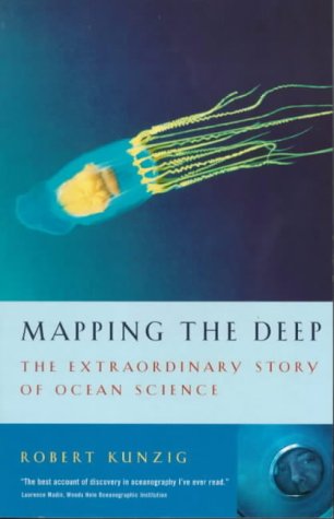
Mapping the Deep: The Extraordinary Story of Ocean Science – Robert Kunzig
Mapping the Deep
Robert Kunzig won the Aventis Science Book of the Year award in 2001 for this book (the 2011 winner was The Wavewatcher’s Companion!). It is an absolutely fantastic piece of science writing, charting the state of the art in ocean science as well as the historical processes that led us to where we are today (or were in 2000).
Kunzig mostly used scientific papers and interviews with the scientists themselves as his primary sources, making complex mechanisms understandable without loss of information in the transmission.
The first few chapters of the book deal with the challenges of finding out what the ocean floor looks like, and of representing it in a useful way. Those beautiful maps of the ocean floor that I pored over in the atlas as a child, or in Sylvia Earle and Linda Glover’s wonderful Ocean: An Illustrated Atlasaren’t as precise as you may think they are – we often repeat the aphorism about how little of the ocean we have explored – but conveniently forget that this also precludes us from making detailed maps of it. The United States Navy probably has the most comprehensive sea floor maps, but they aren’t sharing.
Kunzig devotes several chapters to the type of life found in the ocean – he is not so much concerned with coastal as pelagic life forms, and devotes many fascinating pages to hydrothermal vent communities without once mentioning Robert Ballard. I experienced serious job envy reading about the blue water diving that Bill Hamner did to collect and study pelagic marine organisms such as jellies and plankton.
The influence of humans on the ocean’s environment is the subject of the next few chapters. There is a terrible, compulsively readable chapter about the New England cod fishery that was so convincingly destroyed, even with the assistance of government scientists. The final sections of the book deal with climate change and the ocean.
If you’re in South Africa, get a copy of the book here, otherwise try here or here. This is an updated edition of The Restless Sea, so don’t buy that one!
The False Bay Story is one of a trilogy of books about the notable bays of the south western Cape, written by Jose Burman. The other two books (which I have not read) are The Table Bay Story and The Saldanha Bay Story. This volume was published in 1977, and is chiefly concerned with the colonial history of False Bay. It is well illustrated with early maps (which I found particularly interesting), paintings, drawings and photographs. Burman quotes at length from letters and diaries of the Dutch and British settlers at and visitors to the Cape, which makes this book particularly useful as a collection of primary sources.
The book concentrates on the human settlements: Gordon’s Bay, St James, Kalk Bay, Simon’s Town. Burman pays slightly more attention to the shipping and naval activity in the bay than does Arderne Tredgold in Bay Between the Mountains, with particular attention to how this shaped the settlement at Simon’s Town.
It was Burman’s explanation of why False Bay has that name that finally made sense to me. I had a half remembered idea that it was called False Bay because sailors mistook it for Table Bay, but could never imagine how someone could be that stupid. The truth is that Hangklip used to be known as Cabo Falso (False Cape) by Portuguese seafarers who mistook it for Cape Point. Rounding it, they found themselves in a bay, instead of heading up the western side of the Cape Peninsula heading for Table Bay. False Bay got its name from False Cape. Upon investigation, Wikipedia has this precise explanation. Should I have checked there first, and saved all the time I spent reading this book?