Saturday & Sunday: early launches in False Bay, conditions permitting
Storm clouds at Muizenberg
Visibility in both the Atlantic and False Bay is very patchy today. We dived in False Bay yesterday and had a very dirty top layer, with cleaner and colder water below 10 metres. There is north westerly wind tomorrow and a little rain. There is a 50/50 chance we have cleaner conditions for the weekend.
I would like to launch both days in False Bay if the conditions permit. Let me know if you’re keen to be on board.
Saturday: Boat or shore dives in the morning (early); night dive at Simon’s Town jetty at 7.00 pm
Its been a while since I have seen Muizenberg this clean, not that I go there all that often, but I do think we are going to have really good visibility in False Bay by Saturday and plan to start really early. At this point I have yet to decide on whether to shore dive or boat dive but will make that decision early tomorrow, so please text me your preference.
Muizenberg this evening
Diversnight!
Diversnight takes place on Saturday evening. We will be diving off the jetty in Simon’s Town (note change of location), meeting at 7.00 pm. We need to be in the water at the hour of 8.16 pm (2016!) for our efforts to count towards the official Diversnight aims of, uh, night diving around the world at the same time. There’s a facebook event here, and the official event page here.
Please let me know by 5 pm tomorrow if you’re coming so that I can give the jettymaster the approximate number of divers to expect. If you need any gear, you need to tell me by tomorrow as well please.
After a few days of rain and southerly swell False Bay does not look that great. This swell direction is set to stay for a few more days and in fact changes only on Monday. There is some south easterly wind on Friday and Saturday but not really strong enough to clean up the Atlantic enough for decent visibility.
Storm clouds at Zeekoevlei
I think it may well be a dry weekend as far as diving is concerned, however if things start to look more promising than they currently do, I will be in touch. Let me know if you’d like me to message you if we go diving.
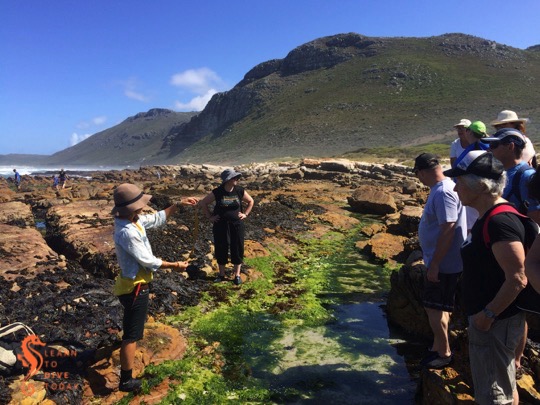
A chance conversation with a friend who also volunteers at the Two Oceans Aquarium led to me enrolling in a coastal foraging course with Roushanna and Gael Gray from Good Hope Gardens, the nursery between Scarborough and Cape Point. Their coastal foraging courses are run during the summer months (I went in December), on dates close to spring tide, so that the maximum possible area of shoreline is available to forage on. The course takes the form of a rock pool expedition on Scarborough beach, followed by lunch – prepared by the participants – at Gael’s beach cottage.
Foraging for edible seaweed
Clouds at Scarborough
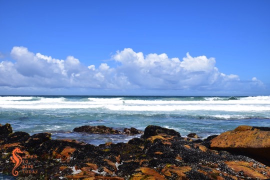
Scarborough beach
Seaweed covered rocks at Scarborough
As I get older I am finding it increasingly difficult to suppress a wildly eccentric streak that frequently finds me – consciously or unconsciously – making small preparations for some kind of apocalypse (zombie or otherwise). This might be related to living on the South African roller coaster for too long, but whatever the origin of this latent anxiety, it has served to make our home life more sustainable and – little bit by little bit – more independent of the electricity grid, the municipal water system, and grocery stores. The idea of coastal foraging dovetails nicely with my desire to learn how to live a little bit more off the land than off the shelves at Woolworths!
Mollusk permit inspection by fisheries officials
It is important to respect some simple rules to ensure that your foraging is sustainable, safe, kind to the environment, and legal. Each of us had purchased a mollusk permit allowing us to harvest mussels, obtainable from the post office (available for R94 using the same form as the scuba diving in marine protected areas permit), and these were inspected by fisheries officials quite early on in our forage. You don’t need a permit to harvest seaweed (however if you wanted to do it on an industrial scale you might need to go through official channels).
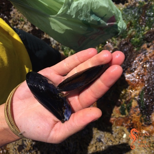
There are three types of mussels found on South Africa shores: the ribbed mussel and black mussel are indigenous, and the Mediterranean mussel is introduced. Unfortunately Mediterranean mussels out-compete the indigenous varieties, and we only saw one or two black mussels while we were out. The mussels we harvested were the Mediterranean variety, distinguishable from black mussels by the thick, flat edge to their shells. Black mussels have pointy edges all around their shells, making them more streamlined.
Mediterranean mussel (left) and black mussel (right)
There is only one type of seaweed growing along our coast that is harmful to eat (acid weed – Desmarestia firma, which has sulphuric acid in its fronds). This brown algae species does not grow on the rocky shore but only further out in the surf zone. This gives rise to the simple rule of only harvesting seaweed that is growing on the rocks, and never collecting seaweed that is floating free.
Purple laver (Porphyra capensis) on the rocks in the foreground
Sea lettuce (genus Ulva)
Hanging wrack: (Brassicophycus brassicaeformis)
When harvesting seaweed, we used a pair of scissors to avoid pulling the entire plant off the rocks, and cut no more than a third of the leaves. Seaweed is full of vitamins and minerals, particularly iodine and potassium. It isn’t something you’d make a whole meal of, but it is a healthful addition to many dishes and – once you know how to prepare it – tastes pretty good!
Clouds at Scarborough
You can read more about the Good Hope Gardens coastal foraging experience here and here. Watch this space for more about what we prepared with our seaweed spoils…
Some time ago I promised to describe the route we took in the Cape Point Nature Reserve to locate the wreck of the Phyllisia, a small fishing trawler wrecked in 1968 and one of the visible shipwrecks around the Cape Peninsula. Here’s that post!
The view from the start of the trail at Gifkommetjie
Tami, Maria and I set out on a slightly drizzly, grey morning from the Gifkommetjie parking area inside the reserve. The first part of the walk was a steep descent down to the beach at Gifkommetjie, where we admired some fishing debris. From there, the trail meanders north, parallel to the coast. Most of the path is sandy, but other parts are rocky and hard-packed.
Milkwood tunnel
The rocky shore near Gifkommetjie
Recently burnt slopes near Hoek van Bobbejaan
The view from the top of the rocky ridge
Tami and Maria in one of the milkwood tunnels
View of Hoek van Bobbejaan from the rocky ridge
There are natural tunnels formed by the overgrowing milkwood trees, requiring a bit of ducking and crouching to go through. The feeling of being in a forest and yet right by the ocean is lovely. After about 2.5 kilometres – the path gradually bends inland – one reaches a T-junction, with an unambiguous sign saying SHIPWRECK, pointing left. If you want to see the Phyllisia, or just get closer to the coast, take that path!
Turn-off for the Phyllisia
It’s another few hundred metres across unclear paths over the dunes to Hoek van Bobbejaan, a promontory with a beach to the north of it (pictured below) that really shows the wildness of this stretch of coast, and how exposed it is to the open ocean. The Phyllisia is right on the outermost point of Hoek van Bobbejaan, and is the same colour as the rocks it’s lying on, so you might need to look carefully!
The beach at Hoek van Bobbejaan
Just above the wreck is one of the (I think) large okoume logs that fell off a ship in Table Bay in 2008 – more on that in this post about the Shipwreck Trail. It’s a great spot to take stock of your surroundings, and a vantage point for photos, as Maria demonstrates below!
Tami and Maria on the log at Hoek van Bobbejaan
To return, follow the path back towards the T junction and keep going straight. The path forks again – the left fork will take you towards Brightwater, and is part of the overnight Cape Point trail. Take the right fork – you should start climbing the rocky ridge that you’ve been walking alongside, towards the level of the parking area.
The return route is along the top of the ridge, along paths that we sometimes struggled to find because the vegetation had been burned away. Upright sticks with red and yellow paint on the end provided some guidance at intervals. The views down over the path you’ve just walked, and back towards Hoek van Bobbejaan, are spectacular.
You can of course, also return the way you came, and do a short, sharp climb at the end back to the parking area, or do the entire walk back and forth along the ridge, skipping the milkwood tunnels, and descend to the shipwreck half way through the route.
We saw bontebok, ostrich, baboons, an angulate tortoise, and wonderful spring flowers in the dunes and on the mountain. The walk took us about three hours at a slow pace, with a regular photo stops. As always, if you go hiking, go in a group (four really is ideal), wear appropriate shoes and a hat, apply sunscreen take waterproof or windproof clothing even if the weather looks nice, bring water to drink, stay on the path, and tell someone where you’re going and when to expect you back.
At the change of seasons from spring to summer we enjoyed beautiful clouds over False Bay, like this example of blue-grey rain clouds seen from Muizenberg.
There are colourful beach huts on St James beach, similar to the ones at Muizenberg. This beach, with its innumerable rockpools waiting to be investigated, is your final destination on the Muizenberg-St James walk, unless you enjoy rock climbing and train dodging. If that is the case, you may continue to Kalk Bay, where breakfast at Olympia Cafe awaits.
Here’s a small sandy and rocky beach, guarded by a huge, almost cubic boulder. It’s located on the route between Muizenberg and St James. I think it’s rather striking. When the tide is out, you might be able to climb on top of it.
On the rocky shore between Muizenberg and St James (accessible via this walk), there are many nooks and crannies, bursting with life that a young marine explorer would derive great enjoyment from discovering. We did the walk close to high tide, on a day with a large swell and the corresponding big waves. I wouldn’t recommend rockpooling in these conditions.